
GoldnBlue
Sunrise, all twilight types, golden & blue hours, sunset, and the moon - at a glance on your wrist.
Wear OS
Tile
6 languages
Sunrise, all twilight types, golden & blue hours, sunset, and the moon - at a glance on your wrist.
Photographers chase the golden hour. Aviators read civil twilight to know when flight rules change. Sailors navigate by the nautical horizon. Astronomers wait for astronomical night. Runners and cyclists plan around the daylight they'll have. Morning-light folks tuning their circadian rhythm watch the same sunrise. Hikers and birders just want to know when the light will go - and come back.
GoldnBlue is a Wear OS Tile that lays the day's solar phases out on your wrist - sunrise, sunset, solar noon, civil/nautical/astronomical twilight, the golden hour and the blue hour - plus the moon's current phase and rise/set. Pick which events you want to see; the tile shows the time of each event and a live countdown to the next one - all for your current location.
The outer ring is a sky-colour gradient that dynamically follows the sun's altitude through the day.
Everything is computed on the watch. The default mode doesn't even ask for permissions: GoldnBlue takes a reasonable guess at your location from your timezone (good to about ±150 km), and only asks for GPS if you switch to precise mode. Optional opt-in place-name lookups are the only thing that ever touches the internet - and only OpenStreetMap, never us.
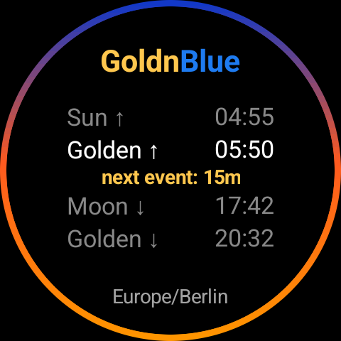
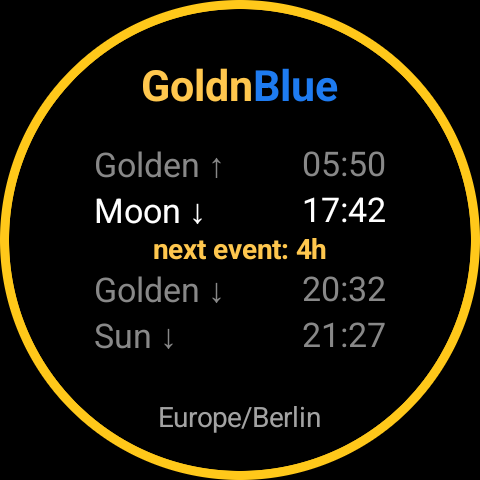
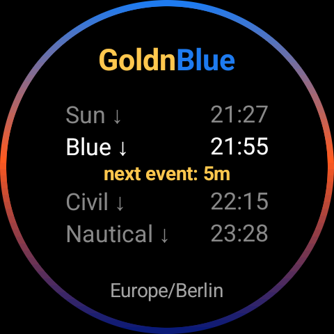
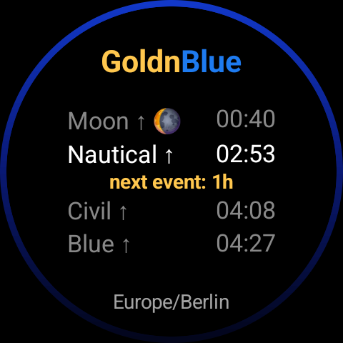
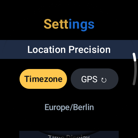
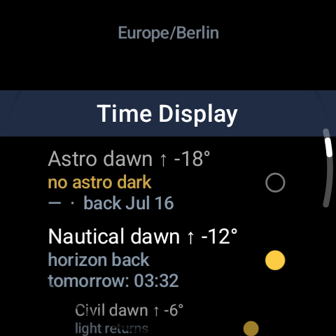
A tile has no launcher icon of its own - here's how to get in, in four steps.
Get GoldnBlue from Google Play, installed directly onto the watch - no phone-side companion app needed.
Long-press your watch face, tap Edit, swipe to the tile carousel, and add GoldnBlue. A tile has no launcher icon - the tile itself is the app.
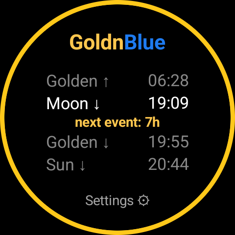
There's no separate app to open - tap the GoldnBlue tile any time and it takes you straight to Settings.
Pick your location precision - Timezone (default, zero permissions) or GPS (one-shot, opt-in) - and choose which of the 15 sun & moon events show on the tile.
Sunrise, sunset, solar noon, golden & blue dawn/dusk, civil/nautical/astronomical dawn/dusk, plus moonrise, moonset and the moon's current phase. Choose which events show on the tile.
The tile's outer ring dynamically shifts colour with the sun's altitude.
Default mode uses your watch's timezone as a coarse location - roughly ±150 km, plenty for everyday use. Zero permissions, zero network. Most users never need anything else.
Tap Re-locate (GPS) in the on-watch settings for a one-shot fix. That location then drives the tile until you re-locate or switch back to timezone mode; a fresh fix is reused for 15 minutes so toggling back and forth won't trigger a new GPS lock.
Opt-in OpenStreetMap lookup turns numerical coordinates into "Berlin, DE" or similar - at your choice of coarse (~11 km region) or precise level. Exactly one request, only when you re-locate.
Tile updates more often when the next event is close, and less often when you're between events. Keeps the countdown accurate without nibbling at the battery.
Pick any of these 15 sun & moon events to show on the tile - listed here in the order they occur through the day.
Exact sunrise, sunset and the various twilights depend on precise location - they happen at very different times in Reykjavík vs. Cape Town. By default GoldnBlue takes a coarse guess from your watch's timezone (good to about ±150 km) so it can show something useful with zero permissions. If that's not precise enough, you can opt in to a one-shot GPS fix.
Everything still works. The tile uses the timezone-centroid coordinates and the sun times are accurate within roughly 15-30 minutes for sunrise/sunset - close enough for most "is it golden hour yet" or "when will it be dark enough for stars" questions. No error state, no nagging.
They're defined by how far the sun has dropped below the horizon. Civil twilight: 0-6° below, enough light to read outdoors. Nautical twilight: 6-12° below, horizon still visible to a sailor. Astronomical twilight: 12-18° below, true astronomical darkness - past this point, even dark-adapted eyes can no longer detect any remaining twilight glow in the sky.
Golden hour: sun between 0° and 6° above the horizon - warm, diffuse light, photographers' favourite. Blue hour: sun between 4° below and 0° - deep blue sky, just-after-sunset / just-before-sunrise glow. GoldnBlue's name and palette come from these two windows that bookend the day.
↑ marks the dawn side of an event, ↓ the dusk side - light increasing vs. fading. Tap through to the on-watch settings to see the full name spelled out for any row.
The outer ring is a soft gradient that dynamically flows through the sky's colours as the sun moves.
No. GoldnBlue is a Wear OS Tile - install it on the watch and use it. There is no phone-side app to install, no pairing, nothing to sync. There's also no separate app icon: once you've added the tile from the watch face editor, tap it any time to open Settings.
GoldnBlue's Wear OS tile is available in English, German, French, Spanish, Italian, and Portuguese - and so is this website.
GoldnBlue follows the EiBPM principles - no ads, no trackers, no accounts, no servers. Here's exactly what that means for this app.
Nothing. No accounts, no analytics, no ads, no crash reporting, no identifiers - and there is no EiBPM data server to send anything to.
Precise location (ACCESS_FINE_LOCATION) is used only when you tap Re-locate (GPS) - a single one-shot fix, used and cached on your watch for the sun maths. It is never sent to us. By default GoldnBlue uses a coarse timezone estimate and needs no location permission at all.
If you turn on place-name lookup, one request with your coordinates - rounded to ~11 km granularity in Coarse mode, or sent at full precision in Precise mode - goes to OpenStreetMap to name your location; the result is cached on the watch. This is the app's only outbound network call, and only when you enable the feature and re-locate. Also see OpenStreetMap's privacy policy.
The cached GPS location and place label stay in the app's private on-device storage until you clear the app's data - switching back to timezone mode deliberately keeps the last fix so a quick return to GPS mode doesn't need a new lock. Uninstalling removes everything.
As a Wear OS app, GoldnBlue is distributed through Google Play - the only practical, device-independent channel for watches (vendor stores are device-specific). The app itself adds no Google licensing or integrity checks and makes no calls to Google; Google Play and Play Services have their own data practices, outside our control.